Maps

Motorcycle Road Trip: Mountains, Rainforest, and the Inside Passage

10 days, 3000 km (1864.11 mi)

A new rider's journey on iconic BC highways.

Share  Facebook Twitter pinterest logoPinterest

This past summer, after having my motorcycle licence for only a month, I decided to road trip some of BC’s legendary highways. Ten days, 3,000 kilometres (1,800 miles), and my small Suzuki TU250X. The trip was amazing. My skills improved each day, and I discovered that riding a motorbike on remote highways connects you to the natural world around you in a way you don’t experience in a car—although any of these highways are worth the trip on four wheels if you don’t ride. Check out the route map and some of my highlights.


Part 1

Sea-to-Sky Highway

The Sea-to-Sky Highway

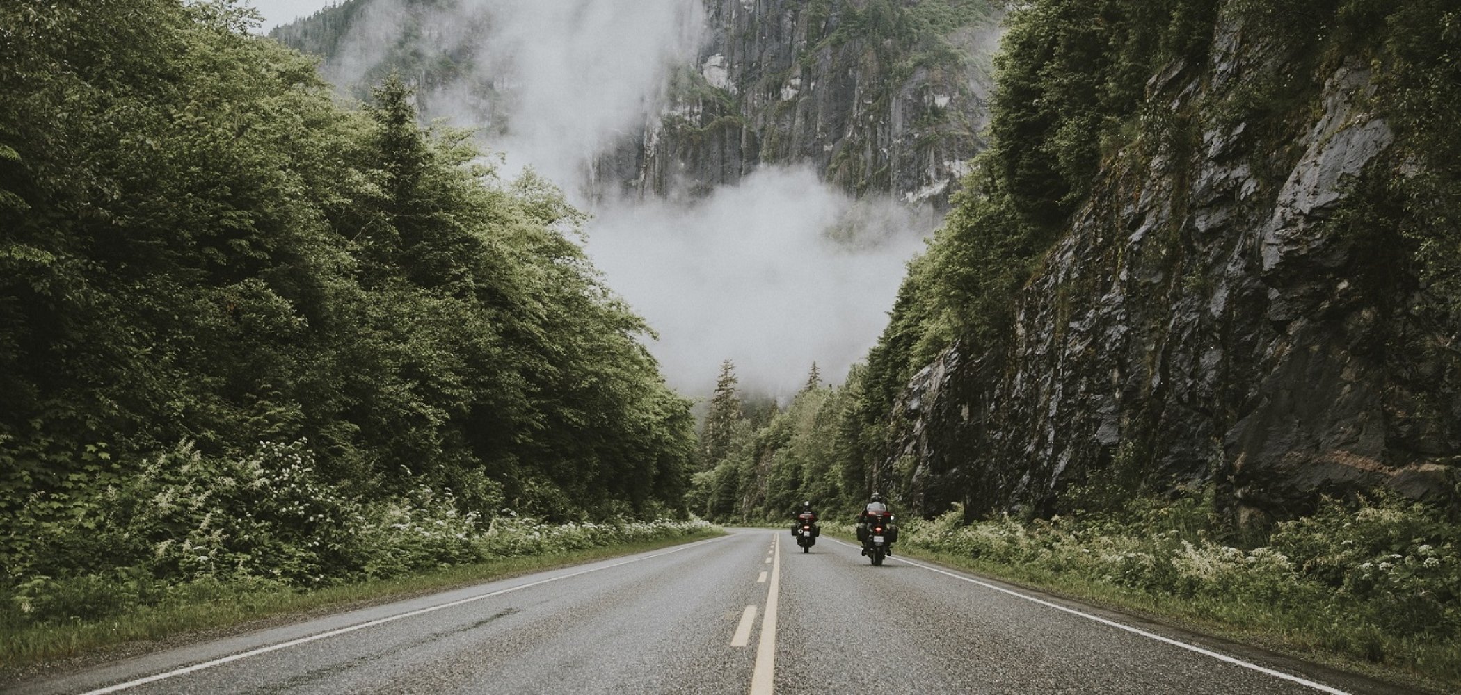
The Sea-to-Sky Highway is a rite of passage for new riders, and before the highway was improved in 2010 it was also considered dangerous. Now the multi-lane highway is much safer, but it’s still easy to get distracted with twists and turns nestled between towering mountains and the Salish Sea. This route starts in Vancouver and follows the Sea-to-Sky Highway through Squamish, Whistler, and Pemberton.

Don’t Miss

Part 2

Duffey Lake Road

Duffey Lake Road | Eric Berger

When you continue along the Sea-to-Sky Highway from Pemberton, it turns into Duffey Lake Road. If motorcycles could dream, they’d dream of Duffey Lake Road. Be ready for sharper corners, steeper grades, and gorgeous lake and forest views. Take your time. There are plenty of opportunities to pull over and soak up the scenery.

Don’t Miss

Part 3

Cariboo Highway and the Gold Rush Trail

Barkerville | Tammy Gagne

The Cariboo Highway is steeped in gold rush history. Years ago, traffic was mainly horse and wagon, and you can still find ranches on this route where you can stay and explore on horseback. Now, the pace of motor traffic has picked up. Perfect for me to see if my small motorbike could keep up—it did.

Don’t Miss

Part 4

Route 97 to Prince George

Huble Homestead near Prince George | Jong Sun Park

Highways 97 and 16 intersect in Prince George, making it an ideal base for exploration. Plan a hike, spend the day fishing, or stay in town for some craft beer and entertainment.

Don’t Miss

Part 5

Route 16 to Terrace

Hudson Bay Mountain from Glacier View RV Park & Cabins in Smithers | Tammy Gagne

Traffic starts to lighten along this stretch of Highway 16. An adventurer’s playground, the area is known for its abundance of lakes, charming communities, rivers, and history.

Don’t Miss

Part 6

Side Trip: Nass Valley via Nisga'a Highway 113

Nass Valley Lava Beds | Tammy Gagne

A hidden gem off Route 16 is the trip to Nisga’a Memorial Lava Bed Provincial Park. Follow Highway 113 (Nisga’a Highway) as it winds around Lava Lake, explore the lava beds, and visit one of the Nisga’a First Nations villages. Continue through the Nass Valley to Laxgalts’ap to visit the Nisga’a Museum.

Don’t Miss

  • Pick-up an auto tour map at the Nisga’a Memorial Lava Bed Park Visitor Centre (built in the style of a traditional Nisga’a Longhouse).
  • Stop for a dip in Aiyansh Hot Springs (a short walk from the highway).
  • Try the fish and chips in Gingolx (Kincolith).
  • Take a guided tour of the volcano.
  • Make sure to fill your tank in Gitlaxt’aamiks (New Aiyansh) before you set off to explore.

Part 7

Route 16 to Prince Rupert

North Pacific Cannery in Port Edward | Tammy Gagne

Another highlight of the trip, this last leg of Highway 16 delivers with corners that wind through towering mountains and lush forest, leading to a breathtaking ocean view and the charming community of Prince Rupert.

Don’t Miss

Part 8

The Inside Passage with BC Ferries

Cruising through the Inside Passage with BC Ferries | Tammy Gagne

The ferry from Prince Rupert to Port Hardy on Vancouver Island takes you on a 15-hour journey through the Inside Passage. Watch for bears, whales, and dolphins as the ferry weaves its way among the coastal islands of the Great Bear Rainforest.

Don’t miss

  • Reserve your spot on the ferry in advance and don’t be late.
  • For some extra comfort, book a sleeping cabin.
  • Check out the lunch barbecue on the top deck.


Part 9

Island Highway

The ferry docks at the north end of Vancouver Island in Port Hardy. Here our sea legs went back on our bikes for the journey down the island on highways 19 and 19A. Highway 19 is fast, and Highway 19A is a slower, scenic, oceanside ride.

Don’t Miss

Last updated: November 30, 2020

Driving Directions

Part 1 - Vancouver
  • 6.25 km
  • 12 min
Show Map & Driving Directions

Places to stay

Search for more

Start Planning

Know Before You Go

Find the latest travel updates for BC.

Learn More
Book Your Trip

Find accommodations, experience providers, and special offers.

Book Now
BC Parks

The official information source for BC's provincial parks and campgrounds.

Learn More
AdventureSmart

Learn the three Ts—trip planning, training, and taking the essentials—and apply them to all your outdoor adventures.

Learn More
Drive BC

Get current road conditions and everything you need before you set off on your BC road trip.

Learn More
Ways to Save

Find partner offers and travel deals to save on your next BC getaway.

Learn More