Maps

Rainforest to Rockies: Along the Trans-Canada Highway

7-10 Days, 778 km (483.43 mi)

A quintessential Canadian journey from Vancouver on the Pacific Coast to the Canadian Rockies along the scenic Trans-Canada Highway 1.

Share  Facebook Twitter pinterest logoPinterest

Rainforest to Rockies logo

Embark on a captivating Rainforest to Rockies road trip that takes you from the Pacific Ocean to the Canadian Rockies. Travel along the Trans-Canada Highway 1 through big cities and canyon towns, alongside lakes and forests, and witness British Columbia’s highlights and highest peaks.

Part 1

Vancouver

Aerial photo of downtown Vancouver | Destination Vancouver/Albert Normandin

Journey through BC’s natural wonders starting in Vancouver, on Canada’s west coast. Find yourself in a picture-perfect and active city recognized by TIME Magazine as one of the “World’s Greatest Places.” 

Located on the shared territories of the xʷməθkʷəy̓əm (Musqueam Indian Band), Sḵwx̱wú7mesh Úxwumixw (Squamish Nation), and səlilwətaɬ (Tsleil-Waututh Nation), the city is a vibrant collection of people and cultures who have lived on these lands for thousands of years, and those who have settled here more recently. 

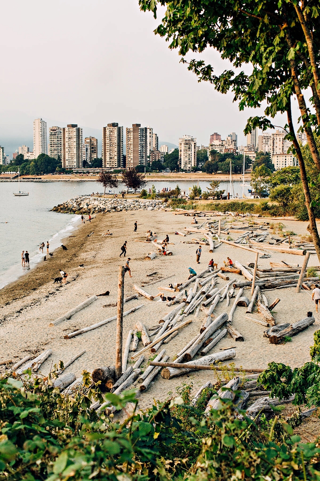
At the foot of the Coast Mountains, surrounded by ocean and peaks, Vancouver is a city you’ll want to spend some time in. Explore unique neighbourhoods and fast-growing Metro Vancouver cities like Burnaby, Surrey, and Langley for shopping, galleries, and museums. Discover sandy beaches, paths, and parks close to town, or venture to the nearby North Shore Mountains to bike, hike, ski, and snowboard, or simply take in the views. 

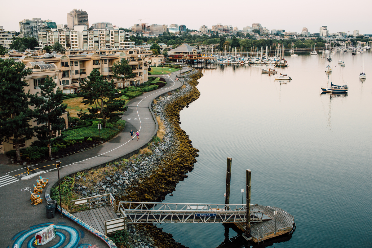
Adjacent to the downtown core is Stanley Park, a sprawling rainforest refuge larger than New York’s Central Park with old-growth trees, accessible trails, and wildlife. Surrounding the park is a 10-km section of “The Seawall,” the world’s longest uninterrupted waterfront path at 28 km.  This biking and walking promenade boasts stellar views at every turn, and a chance to spot curious harbour seals and other marine wildlife.

Vancouver also delivers for foodies. From farmers markets to food trucks, and casual restaurants to MICHELIN-starred contemporary dining experiences, the hyper-local food scene here will satisfy any palate.

Part 2

Vancouver to Hope

Krause Berry Farms & Winery | Hubert Kang

Set off from Metro Vancouver via the Trans-Canada Highway 1, one of the world’s longest national highways. Spend some time getting to know culturally rich communities in the Fraser Valley, where the pace relaxes, fields flourish, and skylines expand.

This is BC’s agricultural heartland. If you’re a foodie, save some belly space for the freshest fare from abundant, family-run farms, dairies, and U-pick berry and vegetable patches. 

Travel east and alongside the mighty Fraser River, one of North America’s major rivers and BC’s biggest at 1,375 km. The Fraser has served as a vital waterway for thousands of years, connecting Indigenous communities along its path. 

Trade the roads for exceptional river adventures. Take a guided fishing tour and cast out for the big ones like salmon, trout or prehistoric sturgeon, or make a huge splash on a whitewater rafting escapade. To relax and unwind after a reel big day, detour to the town of Harrison Hot Springs on scenic Harrison Lake for family-friendly resort fun and to unwind in mineral hot springs. 

Arriving in Hope, a canyon town nestled at the foot of the Cascade Mountains, it may feel familiar. Hope has hosted many film and TV productions including Rambo: First Blood and thrillers Antlers, The Pledge, and Sweet Virginia. To explore the area, hike or bike along scenic riverside trails and watch for the community’s signature chainsaw carvings. 

Part 3

Hope to Lytton

Hell's Gate Airtram | Tourism Hope Cascades & Canyons/Connect Media

Transition from lush valleys to the Fraser Canyon’s steep granite walls where water runs deep. At Hell’s Gate, witness what happens when 750 million litres of water tries to make its way through a 110-foot narrowing. It’s pretty awe-inspiring!

History runs deep here, too. The Nlaka’pamux Nation and Stó:lō Nation have fished for salmon on the Fraser for millennia. In 1857, the canyon experienced a Gold Rush boom as thousands of miners descended on the canyon in search of fortune. Learn more about these unique histories at local sites, heritage villages, and visitor centres. 

As you make your way to Lytton and seek an adventure that takes you off the road and into the rush of the river, try whitewater rafting with REO Rafting & Yoga Resort. This resort offers a piece of secluded bliss with day trips to various river rafting routes (and river tubing!) plus an outdoor hot tub surrounded by nature and relaxation gardens. Or, venture further up to Kumsheen Rafting Resort for more multiday rafting experiences and enjoy the sweeping views of the White Canyon while lounging poolside or soaking in their hot tub.

Part 4

Lytton to Kamloops

Just outside Kamloops | @scottprojectphotography

Towards Cache Creek, the canyon cedes to more arid hills in the lands of the Interior Salish Peoples. During the Gold Rush, Cache Creek was also an important supply stop on the Cariboo Wagon Road, now home to farms and ranches. Gold Country basks in a golden light, and there are many vivid views as you round the bends. Take a side trip to historic Hat Creek Ranch, or venture to Marble Canyon Provincial Park to see a rare limestone formation known as Chimney Rock.

Kamloops is a gently bustling city located at the meeting point of the North and South Thompson rivers. It’s set against grassy hills in Tk’emlúps te Secwe̓pemc territory, on the lands of the Secwépemc Nation.

Visit the Secwe̓pemc Museum and Heritage Park, take a guided boat tour, or attend the annual Kamloopa Powwow to learn more about how Indigenous culture is woven into the fabric here.

Part 5

Kamloops to Revelstoke

The Pipe Mountain Coaster, Revelstoke Mountain Resort | Kari Medig

Leaving Kamloops, grasslands morph into some of BC’s best-loved (and long!) lakes that shimmer under hundreds of hours of yearly sunshine. 

In the area collectively known as “the Shuswap,” lake life unites small communities, and everyone here is passionate about relaxation. This is where you’ll want to kick back and sip local wines and enjoy delectable farm-to-table dining experiences or make a stop or two at the Shuswap Farmstand Trail, where you can discover fresh, local produce and connect with the region’s agricultural heritage.

Go boating in Salmon Arm, or discover why Sicamous is known as Canada’s house boating capital. (Hint: it’s because house boating here is awesome.) 

En route to Revelstoke, at Craigallechie, see where the “Last Spike” was driven on the CP Rail line in 1885, uniting Canada’s east and west by rail. Gain altitude and alpine views as you venture into the Selkirk Mountains and arrive in a quintessential mountain town playfully known as the capital of the “Canadian Alps.”

In Revelstoke (nicknamed “Revy”), it’s hard not to “feel the stoke.” This is THE place for skiers, bikers, boarders, mountaineers, hikers, and backcountry explorers. It’s also home to eclectic and energetic locals who’d spend every day in the mountains if they could. In summer, mountain biking or hiking down intense vertical drops or whizzing down The Pipe Mountain Coaster are your summer best bets, while heli- and cat-skiing operators and the Revelstoke Mountain Resort lure shredders in search of a challenge in winter.

Part 6

Revelstoke to Golden

Golden Skybridge | Kootenay Rockies Tourism/Mitch Winton/Golden Skybridge

The climb through the Selkirk and Purcell Mountains toward the Canadian Rockies promises some of the most scenic drives in BC, with jaw-dropping highlights, and even higher peaks.

In summer, Mount Revelstoke National Park has its own “Meadows in the Sky Parkway”, which proudly boasts alpine meadows blanketed in wildflowers, towering cedar and hemlock trees. In winter, experience the deepest of snow. Watch for wildlife and look up at the stars at any time of year; you’ll probably see plenty of each.

Glacier National Park, the birthplace of mountaineering in North America, lives up to its name with 90 glaciers atop pristine peaks. And Rogers Pass, the second-highest point along the Trans-Canada Highway, is a great place to stretch your legs with a discovery centre, photo ops, and the freshest mountain air. 

Part 7

Golden to Yoho National Park

Taking in the views at Lake O’Hara in Yoho National Park. Photo: @calsnape via Instagram

In Golden on the Columbia River, keep an eye out for a who’s who of wildlife within the Columbia Wetlands, visit Kicking Horse Mountain Resort to bike or hike or visit Boo, their resident grizzly bear, or walk across a canyon with Columbia Valley views on the exhilarating Golden Skybridge suspension bridges. Get a feel for BC’s mountain-town spirit by asking a local to point you to the best views and brews. 

Yoho National Park, a 20-minute drive from Golden, is the eastern bookend of your journey. Yoho is part of the UNESCO-designated Canadian Rocky Mountain Parks World Heritage Site and sits comfortably perched on the Continental Divide of the Americas.

Part 8

Yoho National Park

Takakkaw Falls in Yoho National Park. Photo: @stephaniadeline on Instagram.

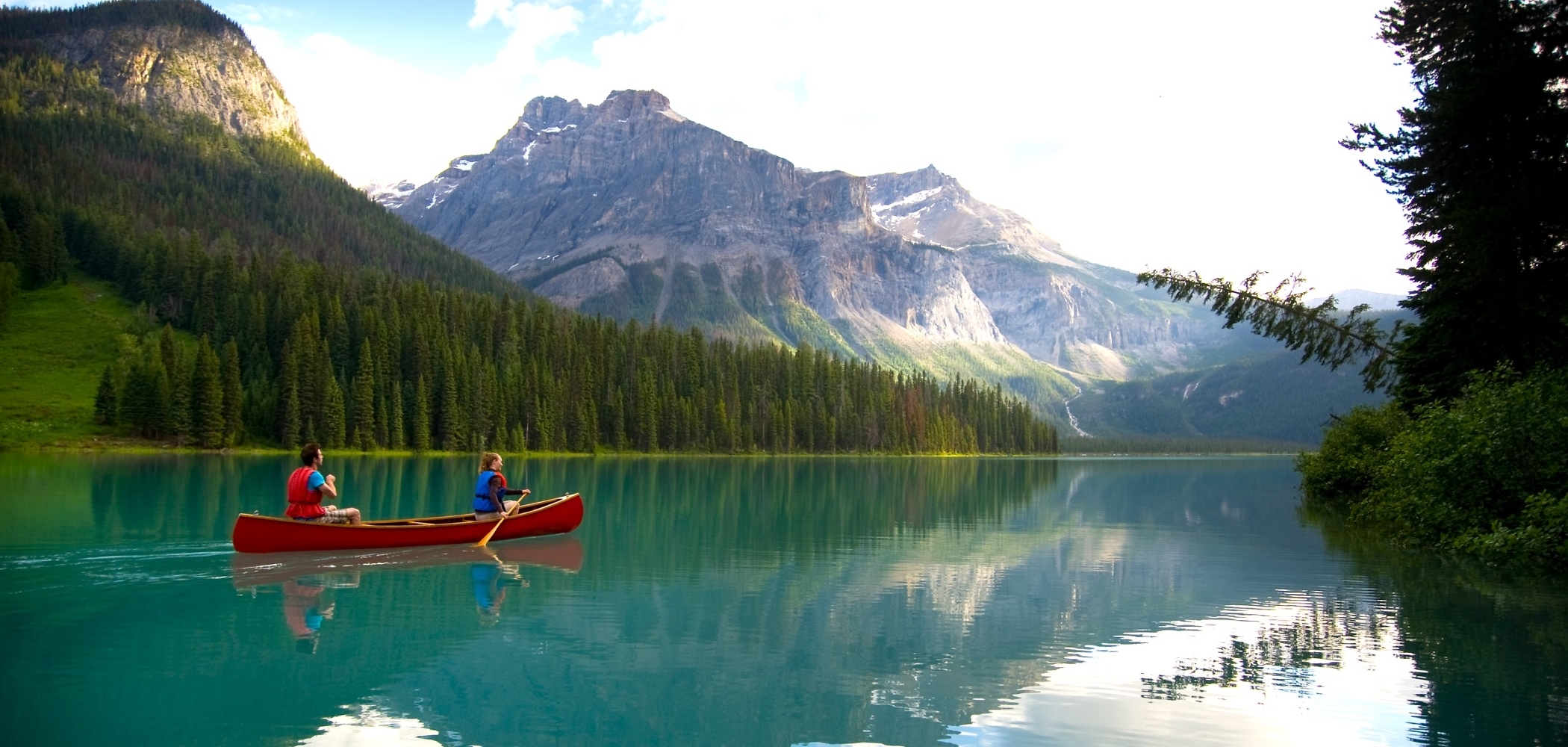
Settle in at a classically Canadian mountain cabin near Field for a few days and take time to uncover natural local gems. Hike to turquoise-green lakes (Emerald Lake and Lake O’Hara are unforgettable, and the latter requires a reservation and shuttle in to visit), to powerful waterfalls (don’t miss Wapta and Takakkaw, one of Canada’s highest), and to astonishing alpine vistas (snag that epic shot of Cathedral Mountain, a 3,189-metre-high massif, or Mount Burgess peak, at nearly 2,600 m).

While marvelling at the mountains, book a guided tour to see the 500 million years of geological history contained in the Burgess Shale fossil beds, and the engineering feat of 1000+ men tunnelling through to create the Upper and Lower Spiral Tunnels, allowing trains like the Rocky Mountaineer to pass through safely. Book a guided visit to the Shale’s quarry or trilobite beds, and stop at the viewpoint of the tunnels east of Field.

Return home having experienced some of BC’s very best. You’ll not often get to explore Vancouver’s forests and ocean, steep canyons and hills, warm lakes and cool mountain towns, and see the glacier-covered pinnacles of the Canadian Rocky Mountains in one trip.


Header image: Emerald Lake in Yoho National Park | Dave Heath

Driving Directions

Part 1 - Vancouver
  • 6.25 km
  • 12 min
Show Map & Driving Directions

Must-visit Gems

Start Planning

Need to Know

Find key travel information to help you plan your trip to BC.

Get Info
Plan Your Route

Check Drive BC for the latest information on road closures around the province.

Check Conditions
BC Parks

Learn about hiking and biking trails, provincial campgrounds, park closures, and more.

Explore
#explorebc

See what's happening now with these recent posts.

Planning a trip to BC? How can I help?
Loading, please wait...
HelloBC AI Concierge is in-training and can make mistakes. Consider checking important information.
Terms and Conditions