Maps
Two people walk across a tall wooden trestle bridge with forested mountains in the background.

Rainforest to Rockies: Trans Canada Trail and Kettle Valley Rail Trail

Share  Facebook Twitter pinterest logoPinterest
Myra Canyon on the Kettle Valley Railway | Kari Medig

Rainforest to Rockies logo

Embark on a panoramic and multi-modal biking, hiking, and road adventure on the Kettle Valley Rail Trail along the Trans Canada Trail.

Want to see BC in a different way? The Kettle Valley Rail Trail, located along the national Trans Canada Trail in southern BC, adds extra adventure to any Rainforest to Rockies road trip. You can experience the trails in a number of ways: a multi-day journey on your own or with an organized tour; rent a bike for the day or take a bike tour. Walk, hike, roll, or bike and follow railbeds across trestle bridges through mountains, valleys, vineyards and desert to the forests and mountains beyond. If you want to make hiking and biking a larger part of your journey, here are a few sections to experience. 

Cycling along the Seawall | Destination Vancouver/Cycle City Tours

Vancouver to Hope

The Trans Canada Trail is a 28,000 km-long trail network stretching across Canada that connects three oceans. The Trail begins in Victoria on Vancouver Island and forks northward and east across the Salish Sea. Board a ferry to Vancouver and explore its expansive networks of trails, including the rainforest paths of Stanley Park, the 28km Seawall and the countless tracks crisscrossing the mountains on Vancouver’s North Shore. 

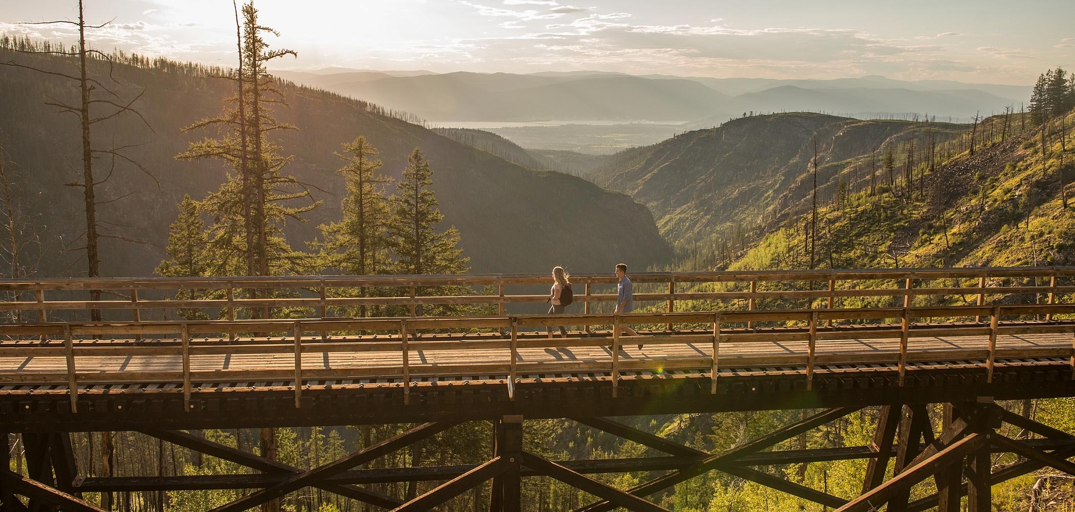
Vancouver is where you’ll begin your Trans Canada Trail journey, travelling through the Lower Mainland of BC and the agricultural oasis of the Fraser Valley heading east towards HopeJust east of Hope, the section of the Trail known as the Kettle Valley Rail Trail (KVR) begins.

Note: The trail is undergoing repair work and sections near Hope are currently inaccessible. It is recommended that you begin and end your KVR journey in Princeton.

Naramata Bench | Hubert Kang

Hope to Penticton

After Hope, the KVR continues towards Princeton and Summerland, following an off-road route with forested views, then meandering from Summerland to Penticton. (Alternatively, head to Kelowna and cycle the 5-ish hours from Kelowna to Penticton along the KVR past charming lakes, trestle bridges, vineyards, and tunnels.)

Situated at the south end of Okanagan Lake, Penticton is a charming base. The city’s farmers market, restaurants, cafés, wineries, distilleries, and breweries satiate souls, while the laid-back lake vibe, beaches, and water activities relax and refresh.

The Trans Canada Trail in Penticton picks up at the west end of the beach and follows an accessible pathway along the lake before connecting with the Penticton Creek Pathway and the Kettle Valley Rail Trail. Bike rentals and tours are plentiful.

A section of the Kettle Valley Railway | Trans Canada Trail
Kettle Valley Rail Trail near Oyama | Thompson Okanagan / Melissa Barnes

Penticton to Naramata

What do you get when you combine scenic views, fruit stands, vineyards galore, and a historic railway? The Penticton to Naramata route of the KVR follows the Naramata Bench along orchards and vineyards, with some of the best wine the province has on offer. Head north to the Little Tunnel lookout. Blasted through the rock around 1915, Little Tunnel is one of the highlights of the rail trail, offering a glimpse into the history of the KVR along with stunning views of the Okanagan Valley in both directions.

Myra Canyon near Kelowna | Grant Harder

Naramata to Myra Canyon via Chute Lake

Head east from Naramata towards Chute Lake, watching for Rock Ovens Regional Park, a collection of historic rock ovens along the KVR. These ovens were built between 1911 and 1915 and were used by railway workers to prepare their food. Continue onwards to Myra–Bellevue Provincial Park.

Perhaps the best-known section of the KVR, this part of the route promises exceptional views of Myra Canyon, with forested hills and dramatic rocky canyon walls. Travel over historic trestle bridges—18 in all—and through two tunnels along the former railbed. This section of the Trail is reserved for the exclusive use of non-motorized vehicles and is a great walking, hiking, and cycling stretch.

Trans Canada Trail

Myra Canyon to Midway and Fernie

From Myra Canyon, the Kettle Valley Rail Trail continues east and then south to Midway, named for its location between the Pacific Ocean and Canadian Rockies. Find epic views, countless additional biking trails, hiking routes, campsites, and rustic communities. Stop at the Midway Museum, known as “Mile 0,” and the most westerly point of the KVR.

The Trans Canada Trail continues along various picturesque trails and paddling routes (including the Columbia & Western Rail Trail between Christina Lake and Castlegar, Grey Creek Pass, Northstar Rails to Trails, and the Chief Isadore Trail). The BC portion of The Trans Canada Trail ends in Fernie. From here, it links to the High Rockies Trail in Alberta before continuing east.

Learn more about British Columbia trail sections and explore the Trans Canada Trail map. Always check for guidance and the most up-to-date information about trail access and safety, and download the AccessNow app for accessibility information on sections of the Trans Canada Trail.

Start Planning

Need to Know

Find key travel information to help you plan your trip to BC.

Get Info
Plan Your Route

Check Drive BC for the latest information on road closures around the province.

Check Conditions
BC Parks

Learn about hiking and biking trails, provincial campgrounds, park closures, and more.

Explore