


From Vancouver, head north along the scenic Sea-to-Sky Highway. The road winds around rock faces, cliffs, and trees and offers incredible vistas of Howe Sound. Stop at the roadside Britannia Mine Museum on the way to Squamish.
Witness the powerful effects of nature on this scenic route through diverse mountain landscapes, starting and ending in Vancouver.
Part 1
From Vancouver, head north along the scenic Sea-to-Sky Highway. The road winds around rock faces, cliffs, and trees and offers incredible vistas of Howe Sound. Stop at the roadside Britannia Mine Museum on the way to Squamish.
Part 2
Continue along the Sea-to-Sky Highway to Squamish, which bills itself as the “Outdoor Recreation Capital of Canada.” Look for bald eagles by the river, watch kitesurfers at the Squamish Spit, tackle the mountain bike trails, or try river rafting, when the weather serves. Take a break in town by sampling fare from one of the local proprietors—including a stop at one of Squamish’s many breweries or cideries. Also consider visiting the open-air West Coast Railway Heritage Park museum, the home of western Canada’s largest assemblage of historical railway rolling stock, including artifacts, paraphernalia, and collectibles dating to 1890. On your way out of Squamish, consider a stop on the northbound pullout (it comes up fast so look for the parking lot just opposite the main turnoff) to take in views of the narrow and jagged range of glistening white glaciers that tower over the Squamish River, crowned by 2,603-metre (8,540-foot) Mt. Tantalus.
Part 3
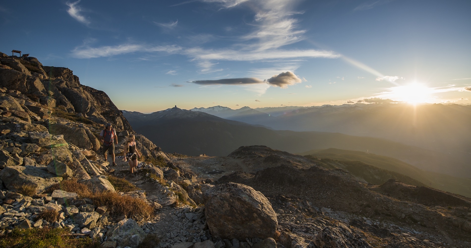
Make sure to allocate ample time in Whistler. Along with outdoor adventures such as biking, hiking, bear watching, or riding the PEAK 2 PEAK Gondola, there are more urban pursuits in the Village, such as shopping and dining. Take to a walk down one of of the branches of the Valley Trail network, or grab a mountain bike and head to the Whistler Mountain Bike Park.
Make sure to visit the cultural exhibits at the Squamish Lil’wat Cultural Centre for insight into the Indigenous peoples of this area. Peruse the permanent collection and visiting exhibitions of the Audain Art Museum, which offer a visual journey through the history of art from coastal British Columbia, including one of the world’s finest collections of Northwest Coast First Nations masks.
Continue driving north of Whistler to quiet (and pretty) Pemberton, then on to Lillooet, known as the start of the road for the Cariboo Gold Rush. There are some interesting historic sites to discover here.
Part 4
From Lillooet, there is the option to drive south to Lytton, or northeast through picturesque grasslands and canyons (the northeast option is shown on the map). If you’re taking the northeast route, visit Historic Hat Creek Ranch to sample pioneer life at an 1860s roadhouse featuring more than 20 restored heritage buildings and displays, before you continue on to Lytton.
Part 5
The Fraser Canyon landscape includes the river rushing past steep walls and gorges, and farmlands flanking the mountains. To gain an appreciation for the power of the Fraser River, stop at Hell’s Gate to ride the Hell’s Gate Airtram, which takes you over the river’s narrowest point, just 35 metres (115 feet) wide. Or, try whitewater rafting with Kumsheen Resort, one of the few accommodations to survive a 2021 fire that destroyed much of the Village of Lytton.
En route to Hope visit Historic Yale, part of the original Cariboo Wagon Road, which offers an intriguing look at the gold rush boom of the 1800s that brought miners to the gold fields of the Cariboo and Barkerville.
Part 6
Hope is a major junction for road trip travellers, some of whom drive through and miss the unique attractions in the area. View the chainsaw carvings that are scattered throughout town, or stretch your legs with one of the many scenic hikes in the area.
Natural mineral water at Harrison Hot Springs makes this a logical place for a stopover and a relaxing plunge into steamy pools. The artificial lagoon at Harrison Lake is also a prime spot for kicking back outdoors, if the weather serves.
Part 7
From Harrison Hot Springs, choose either the northern or southern bank of the Fraser River to return to Vancouver. The northern route (shown on the map) follows scenic Highway 7 past Mission, Maple Ridge, and Pitt Meadows, while the more direct southern route follows Highway 1 past Chilliwack, Abbotsford, Fort Langley, and New Westminster.
Featured image: High Note Trail, Whistler Mountain | Blake Jorgenson
Last updated: August 17, 2022
See what's happening now with these recent posts.
Always check trail conditions before you head out, and no matter what outdoor activity you are planning, be prepared.
Plan Your RouteCheck Drive BC for the latest information on road closures around the province.
Check ConditionsFollow these tips to travel safely and responsibly in BC this season.
See the TipsDiscover everything from luxury hotels and B&Bs to wilderness lodges and campsites.
Find Accommodation