


Introducing: The Trip of the Year
What you need to know about BC’s epic Rainforest to Rockies cross-province journey:
- Traverse the province west to east, immersing in nature and culture, from the ocean to the mountains
- Three main driving routes start in Vancouver, averaging seven to 10 days
- Or, opt to take a train, hike, or bike
![]()
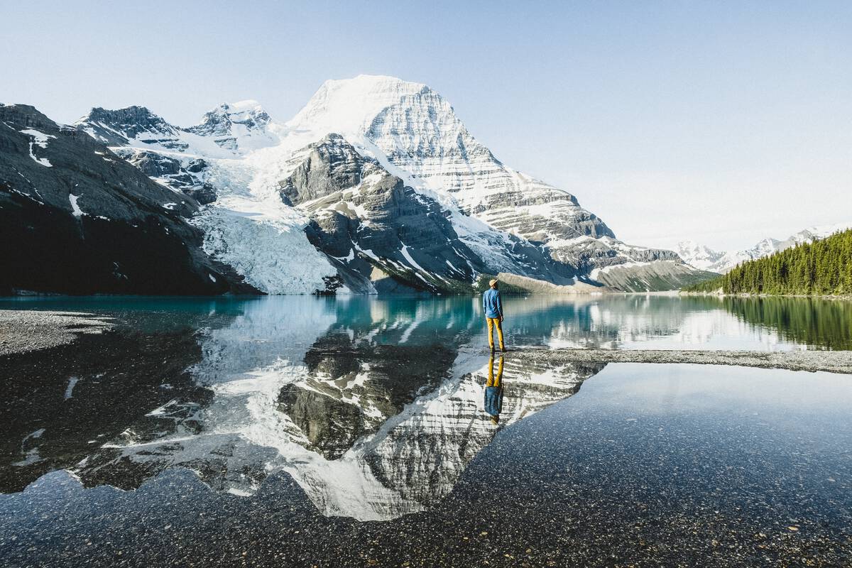
It’s the journey you’ve been waiting for. From sea to sky, Rainforest to Rockies is a trip of your making and on your own timetable that encapsulates the essence of British Columbia, from its singular coastal rainforest to its iconic Rocky Mountains. Stop in the lesser-known, but equally fascinating in-between places.
All routes start in Vancouver, one of the world’s great cities, thoroughly modern, edged by the Pacific, enveloped by coastal rainforest, and enlivened by old and new cultures. These are the traditional territories of the Musqueam, Squamish, and Tsleil-Waututh Nations and the immigrant landing places of new Canadians, and there’s no better place from which to embark than at Stanley Park, a rainforest refuge larger than New York’s Central Park, with old-growth cedar trees, cycling trails, and wildlife. From this place of grounding, chart your own course, following one of the routes below. Check out full itineraries and variations here; routes end at the far eastern side of the province. Return to Vancouver by an alternate route, or continue on to Calgary, an international gateway in the neighbouring province of Alberta.
Emerald Lake, Yoho National Park | Destination BC
The Classic: Along the Trans-Canada Highway
- The essence of BC, from big cities to canyon towns, valley floors to mountain ridges, rivers to lakes to cascades
- Experience nature touched by and tied to a history going back millennia
- 778 km (483 mi) along the Trans-Canada Highway, ending at Yoho National Park
Looking for the quintessential BC journey? This is it. Cruising west along Highway 1— Canada’s version of U.S. Route 66—this classic route captures the essence of BC, from city to village, valley to mountain, from rivers to lakes to waterfalls, all inextricably tied to a history that extends back thousands of years.
You’ll cross the province on one of the world’s longest road systems—Highway 1, also known as the Trans-Canada Highway. Head east alongside the Fraser River, BC’s biggest, where Nlaka’pamux and Stó:lō First Nations have long fished for salmon, on to Hope. At the foot of the Cascade Mountains, this quirky canyon town has been used for movie sets (Rambo) and hosts an annual chainsaw carving event that attracts masters of the art the world over. Keep following the river through steep canyons and rushing waters (experience it on the Hell’s Gate Airtram) to its confluence with the Thompson River and the lands of the Interior Salish Peoples, also an important supply route during the Gold Rush. In Kamloops, amid the grasslands at another river confluence, stop at the former Indian Residential School for some difficult but important context. Leaving town, the grasslands give way to BC’s best-loved lakes in the area collectively called the Shuswap. Sicamous is known as Canada’s houseboating capital, so try it here.
The final leg takes you through the Selkirk and Purcell mountains toward the Canadian Rockies: expect high peaks, glacial lakes, and epic ‘scapes. The Capital of the Canadian Alps, Revelstoke serves as home base for skiers, bikers, boarders, mountaineers, hikers, and backcountry explorers. You can do the same, or push on to Glacier National Park (not to be confused with the park with the same name in the U.S. state of Montana). Stop in Golden (pop. 3,986) to check out the views from the Golden Skybridge, Canada’s highest suspension bridge. The endpoint does not disappoint: Yoho National Park is part of the UNESCO-designated Canadian Rocky Mountain Parks World Heritage Site and sits perched on the Continental Divide of the Americas.
Ktunaxa elder in regalia next to a teepee at St Eugene Golf Resort | Destination BC/Kari Medig
Winding Road: Crowsnest Highway 3 to the Canadian Rockies
- A slow, southern route for culture buffs and foodies, focusing on how various cultures interact with a varied landscape
- Farm-fresh, organic bounty, from 30 varieties of tomatoes to nine recognized appellations of wine
- 1,035 km (643 mi) via Crowsnest Highway, ending in the mountain town of Fernie
The most southerly of the Rainforest to Rockies routes skirts the border above the U.S. states of Washington, Idaho, and Montana. It’s the choice for those who want to experience the interplay of landscape and people. Taste and sip from the bounty of Similkameen Valley, known as both the Organic Farming Capital and the Fruit Stand Capital of Canada. Delve into the histories of Indigenous Peoples in the semi-arid desert, in old mining towns, and Japanese immigrants in World War II-era internment camps.
You’ll leave Vancouver following the Fraser River to Abbottsford, where the cityscape fades into a carpet of farms and fields; stop for berry wine on a self-guided farm tour. Jump on Highway 3 (Crowsnest Highway) and continue east toward the Harrison River Valley, home to the legendary Sasquatch (a.k.a. Bigfoot or Yeti). It’s more than just a story; oral histories go back thousands of years and the Sts’Ailes People believe the elusive creature is the primary caretaker of the land—a spiritual being that can vanish into the spirit realm at will. Ponder that thought while dipping into one of the valley’s signature hot springs.
A Canadian desert? Learn about this unique ecosystem and how the Osoyoos Indian Band thrives in it at the NK’Mip Desert Cultural Centre in Osoyoos. Visit Greenwood (pop. 665), which held some 1,200 Japanese-Canadian internees in 1942. Ascend into the Selkirk and Purcell ranges, stop for wine in Cranbrook, and learn about the language of the Ktunaxa People, distinct from any other in the world. And then, the towering Rockies. Your final stop is Fernie, a former railway and coal mining town, now a haven for those whose idea of a good life, like yours, is slowing down to connect with people and nature.
Hiking in Mount Robson Provincial Park | Destination BC/Megan McLellan
Big and Wild: North to Mount Robson
- An active, adrenaline-pumping journey with a backdrop of sweeping proportions
- From secret trails and solitary paddles to challenging climbs and wildlife watching
- 709 km (441 mi) via the Sea-to-Sky and Yellowhead highways, ending in Mount Robson
Aiming for epic landscapes and peak outdoor adventure, this route features hit after hit: from one of the world’s most scenic drives, to North America’s leading mountain resort, to the tallest peak in the Canadian Rockies. Parks offer opportunities to view megafauna and play in deep canyons, limpid lakes, sprawling grasslands, and vertical slopes.
From Vancouver, drive up Highway 99, known as the Sea-to-Sky Highway, including the 120-km spectacular stretch from Vancouver to Whistler, with islet and fjord views of UNESCO Biosphere Region Howe Sound from the car window, or better, from the Sea to Sky Gondola. Squamish is the Outdoor Recreation Capital of Canada, home to many Olympic athletes; gear up here and don’t miss rock climbing or hiking around Stawamus Chief, one of the largest granite monoliths in the world (but do follow posted signs and keep your distance from wildlife, especially nesting peregrine falcons).
Wind your way through the rugged Coast Mountains, through rushing rivers and heady switchbacks. Heading east along Highway 1, the landscape morphs into sagebrush and then morphs again into canyons and cliffs. Kamloops Lake is a flyfisher’s dream for a strain of rainbow trout found only here. North of Kamloops, watch for bighorn sheep and mule deer at Lac du Bois Grasslands, and cactus and rock spires—or hoodoos—along Cinnamon Ridge Trail.
Highway 5 (Yellowhead Highway) follows the twists and turns of the North Thompson River to Wells Gray Provincial Park for birding, boating, or viewing extinct volcanoes and lava beds; book a night at a place like Well Gray Guest Ranch to tap into your inner cowpoke. You’re within a couple hours’ detour to Sun Peaks for lift-accessed mountain biking and alpine hiking in summer, and skiing the country’s second-largest ski area in winter.
The peakiest of peak experiences awaits at Mount Robson, at 3,954 metres the tallest and, arguably, most stunning pinnacle in the Canadian Rockies. While not deemed technical, climbing it is a serious undertaking. If you aren’t up for it, opt for a hike matched to your fitness level in Mount Robson Provincial Park, keeping your eye out for golden eagles, mountain goats, or even a grizzly, and your camera set on Pano mode for the 360-degree vistas.
A group with Takaya Tours, rowing a traditional First Nations canoe in Howe Sound | Destination BC/Patrice Halley
More Ways to R2R
- Endless permutations, detours, and extensions
- Hike, bike, or even horseback ride portions of the journey
- Or, sit back and experience the route by luxury train
While the Rainforest to Rockies journey has three main driving routes, there are myriad combinations and detours, from a grand circle tour encompassing 2,195 kilometres (1,364 mi) to a focus on the Coastal mountain landscapes to an extension to Mile 0 of the Trans-Canada Highway 1. Choose your path and set your pace.
Hikers, cyclists, and even horseback riders can jump on one of Canada’s most spectacular rail-to-trails paths, the 650 km (400 mi) Kettle Valley Rail Trail, part of the Trans Canada Trail. You’ll roll through the countryside before ascending into the mountains, going through long tunnels and crossing trestle bridges perched hundreds of feet over canyons. It’s just one of many scenic trail options.
Or, ride the rails in style. The luxury train operator Rocky Mountaineer offers three routes starting or ending in Vancouver that traverse the province over three days. View the scenery by day from glass-domed coaches and spend nights in fine hotels along the route.