


What is a UNESCO Global Geopark,
And Why You Should Visit This One?
Learn about Tumbler Ridge, one of five Global Geoparks in North America and the only one in western Canada.
Guest post by Andrew Findlay
A half hour’s drive west of Williams Lake, Highway 20 swings beneath the forested flanks of Desous Mountain, crosses the swirling currents of the Fraser River, then contours up the other side of the valley. It’s here, with the vast Chilcotin Plateau unfolding toward the Coast Mountains, that a sense of adventure, of leaving behind one world and entering another, truly sets in. Of all the ribbons of asphalt I have travelled throughout British Columbia, Highway 20 stands out as a place where frontier spirit still burns strongly, and the country feels wide open and full of possibility. It’s a place that calls out “road trip.”
So what should you see and where should you stop? Here’s what my road trip might look like if I followed my impulse to venture along Highway 20.

The road to Farwell. Photo: Geoff Moore
Roughly 30 km (18 mi) further west of the Fraser River, among the rolling hills and grasslands of Riske Creek, I’d stop in at historic Chilcotin Lodge. It’s an ideal base for a side trip to see the sculpted hoodoos and bighorn sheep of Farwell Canyon, which are frequent visitors to the steep cliffs and sandy bluffs found along this bend in the Fraser River. Then I’d continue south to Big Creek Lodge, where you can saddle up trail horse at this classic working Chilcotin ranch, before rejoining Highway 20 at Hanceville.
As the Highway 20 road trip continues westward, Bull Canyon Provincial Park on the banks of the turquoise-coloured Chilcotin River is a must-stop for a picnic and riverside walk to stretch the legs. Beyond Alexis Creek is Puntzi Lake, famed for its Kokanee and rainbow-trout fishing.

The Chilcotin scene near Farwell Canyon. Photo: Geoff Moore
At Tatla Lake, you sense the landscape changing. Rolling, lake-dotted hills and grasslands give way to rugged and remote mountains on the near horizon. The land is sparsely populated, the sense of raw wilderness visceral and immediate. Yet character-filled lodges and resorts tucked in valleys, next to lakes, and nudging up against mountains are like islands of refuge and comfort.
At Tatla Lake I’d branch south onto Tatlayoko Road, then onto Bluff Lake Road following it all the way to the south end of Bluff Lake, where you’ll find White Saddle Country Inn. With self-contained cabins, a hand-built log lodge, and a Finnish sauna next to Mosley Creek, this is luxury, off-grid-Chilcotin style. This family-run operation offers valley bottom hiking, mountain biking, and photography, as well as high alpine adventures and helicopter tours courtesy of White Saddle Air Services.

Sunrise at Bracewell’s Alpine Wilderness Adventures. Photo: Geoff Moore
Or, I’d stay on Tatlayoko Road and head for Bracewell’s Alpine Wilderness Adventures. Established in 1918, it has seen three generations of Bracewell family hospitality, with guests guided by horseback into mountain valleys and lakes for a day of fishing in solitude.
Family tradition is part of country living. Just ask the folks at the Homathko River Inn, also on Tatlayoko Road and located on the Circle X Ranch, one of the pioneering cattle ranches in the Tatlayoko Valley. Or ask the owners of Terra Nostra Guest Ranch, back on Highway 20 beyond the tiny roadside hamlet of Kleena Kleene. There, you can paddle a canoe or kayak on Lake Clearwater, enjoy a trail ride on a horse suitable for novice or advanced riders, or hike a sign-posted trail leading out from the lodge like the spokes of a wheel into the pristine Chilcotin.
The high country beckons further on where the peaks of Tweedsmuir Provincial Park—BC’s largest provincial park—rear up to the big blue sky. That’s when I’d pull into the Retreat Wilderness Inn on Nimpo Lake, where urban sensibilities meet Chilcotin grit. Maybe a weekend yoga retreat is what you need, or simply an evening standup paddle on Nimpo Lake as the loons call, before nighttime ushers you into the lodge for a cocktail by the fire.

Tweedsmuir Air Services at Nimpo Lake. Photo: Kari Medig
I’d linger at Nimpo for awhile, knowing that it’s also the base of Tweedsmuir Air Services. From here, you can book a charter in a de Havilland Beaver floatplane—the taxicab of the BC backcountry—for a 20-minute flight into Turner Lakes. Before leaving, pre-arrange a canoe rental, whether for a multi-day or day-long paddling adventure on this chain of seven lakes. An easy 20-minute hike from Turner Lake brings you to the brink of Hunlen Falls, one of Canada’s highest waterfalls at 400 m (1,312 ft) of continuous drop to the valley below, where it flows into Lonesome Lake and then Stillwater Lake, forming the headwaters of the Atnarko River bound for the Bella Coola Valley.

Hunlen Falls and Turner Lake from the air, Tweedsmuir South Provincial Park. Photo: Kari Medig
That would be my next stop after descending the legendary “Bella Coola Hill.” (In the early 1950s, when the BC government decided not to build a road linking Anahim Lake to Bella Coola, locals fired up their bulldozers and built it themselves.) From Heckman Pass, the road drops in a series of hairpin switchbacks for more than 40 km (25 mi) from the pine and spruce forests of the plateau to the towering cedar and hemlock groves of the Bella Coola valley. By the time I reached the tide line at Bella Coola—where a new BC Ferries service started this summer direct to Port Hardy on Vancouver Island aboard the Northern Adventure—my cup would be full.
That’s what my Chilcotin road trip adventure would look like. You could rush, but taking your time on Highway 20 pays dividends in memories that will last a lifetime.
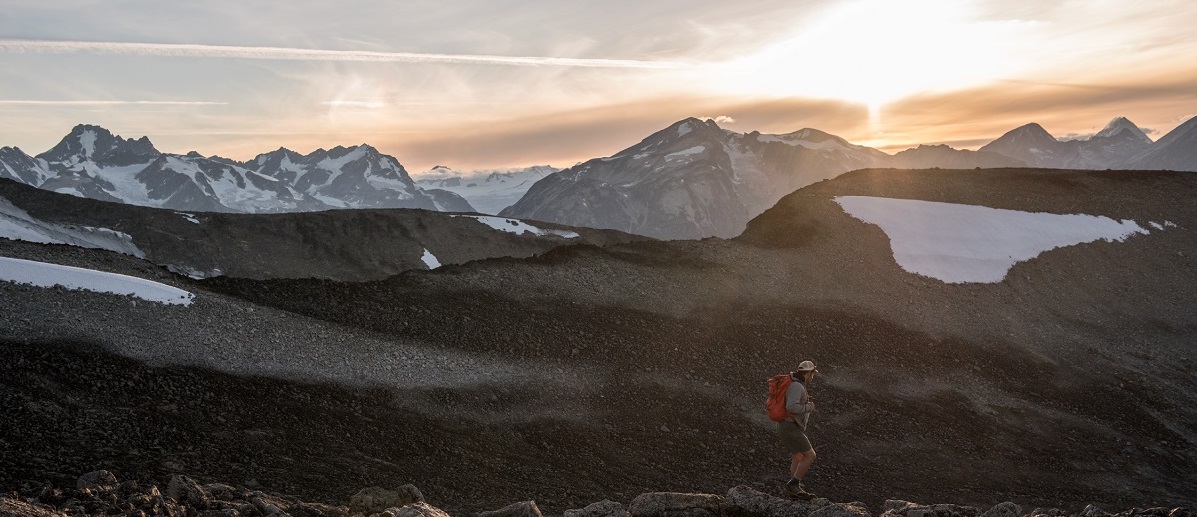
Opening image: View of the Coast Mountains from the plateau above Wilderness Lake. Photo: Kari Medig