


Vancouver to the Rockies
7 to 10 days / 1950.47 km (1212 mi)
A visit to British Columbia is not complete without a trip to the Rocky Mountains, one of Canada's most iconic and inspirational destinations.
Travelling by RV allows you to bring the comforts of home into the wild nature of BC, thanks to camping options that range from full-service glamping sites to rustic, natural retreats. Here are some ideas to help you plan an RVing adventure from BC’s Coast to the Rocky Mountains.
Option one via the Trans-Canada Highway (Vancouver, Kamloops, Revelstoke, Golden, Banff)
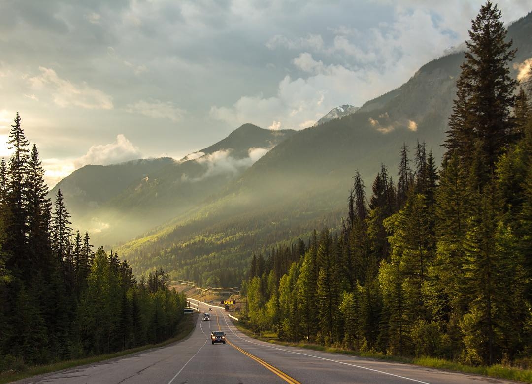
Rogers Pass on the Trans-Canada Highway. Photo: @_miss.mandy_ via instagram
The Trans-Canada (also referred to as Highway 1) is a direct and well-travelled RV route. If you’re not comfortable with mountain driving, exit the Trans-Canada at Hope for the Coquihalla Highway. Connect back to the Trans-Canada in Kamloops, or continue through the Okanagan Valley via Kelowna and Vernon and reconnect in Sicamous. Spend time in the mountain parks; locomotive fans will want to check out the railway museum in Revelstoke and the Spiral Tunnels in Yoho National Park.
For a change of scenery, consider taking Highway 8 off the Trans-Canada at Spences Bridge, which traces the Fraser Canyon along the Nicola River.
Option two via Sea-to-Sky/Highway 99 to Highway 5 (Vancouver, Whistler, Lillooet, Clearwater, Valemount, Jasper)
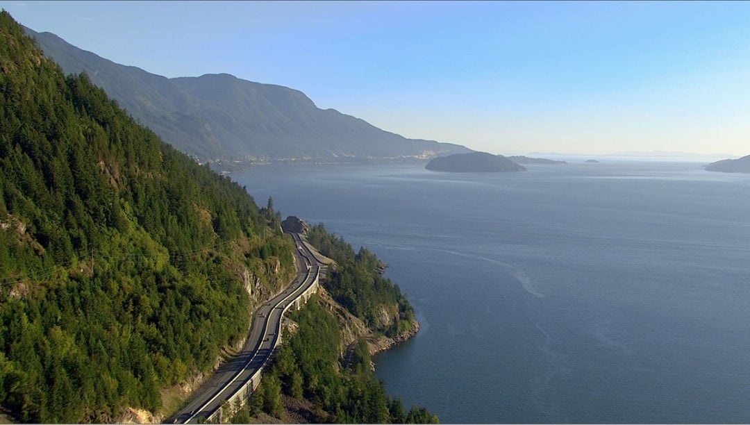
Sea-to-Sky Highway (Highway 99) | Destination BC
This route travels BC’s coastline with breathtaking views of the ocean on one side and jutting rock on the other. Be aware that the road can be narrow and twisty, with sharp corners and some steep areas (especially the Duffy Lake section).
A more direct option is to take the Trans-Canada route, and then connect to Highway 5 in Kamloops.
Option three via Highway 3 and the Kootenays (Manning Park, Osoyoos, West Kootenays, Banff)
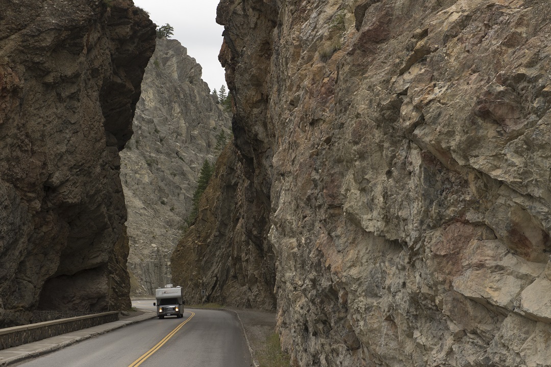
Sinclair Canyon, the entrance to Kootenay National Park and Radium Hot Springs | Kari Medig
The Highway 3 route from Hope and through the Kootenays is a spectacular drive, passing through parks, small towns, and mountain ranges. Be aware, Allison Pass in Manning Park has some steep grades.
Consider these stops:
Depending on your route, driving from Vancouver to the Rockies is approximately 800 km (500 mi)—eight to 10 hours driving time—up and over several mountain passes. Routes go from coastal waters, through rainforest, desert, wine and orchard country, mountain ranges, small towns, parks, and historic railway and gold rush sites. Give yourself time to stop, stay, and explore along the way.
Many RV rental companies allow you to pick up your rental in Vancouver and drop it off in Calgary (or vice versa). Click here for more tips on renting an RV in BC.
San Juan River on BC’s coast. Photo: @theworldinwhich via instagram
Find RV-friendly campsites here. After a long drive, avoid having to back in by calling ahead and reserving a site with a pull-through spot.
You can also camp at parks along your way. No matter which route you choose, you’ll pass through both provincial and national parks. Here are just a few to visit:
Spring, summer, and fall months are the best times to be on the road, but high-elevation areas are known to have snowstorms in April, May, and October.
Reserve your provincial park campsite here.
Plan your Trans Canada Highway route here.
For up-to-the-minute BC road conditions visit Drive BC.
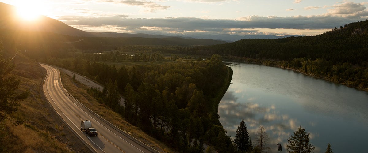
Featured Image: Driving along Highway 3 next to the Kootenay River | Keri Medig.
See what's happening now with these recent posts.
Learn the three Ts—trip planning, training, and taking the essentials—and apply them to all your outdoor adventures.
Learn MoreGet current road conditions and everything you need before you set off on your BC road trip.
Learn More