


North Tweedsmuir Provincial Park
Length -
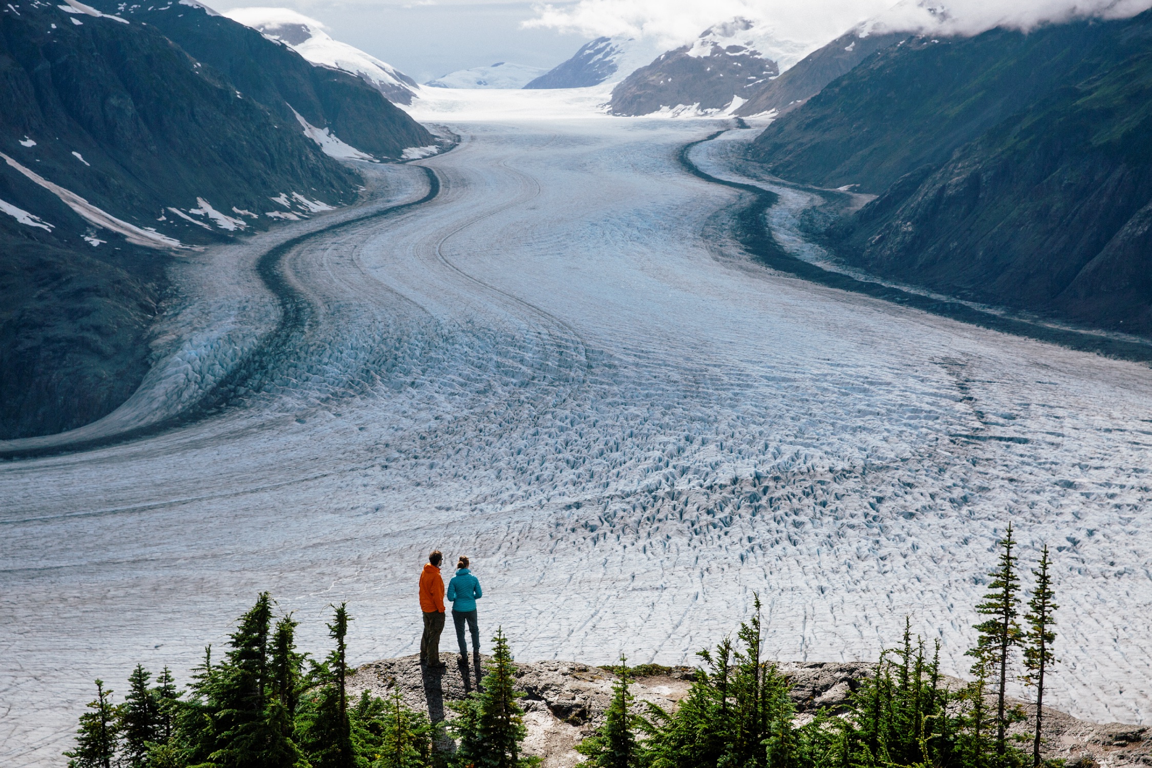
![]() BC’s northwest stretches up to the Yukon/Alaska border, showcasing dramatic glaciated valleys, volcanic rock formations, mountain ranges, and mist-shrouded rainforest, anchored by the port city of Prince Rupert.
BC’s northwest stretches up to the Yukon/Alaska border, showcasing dramatic glaciated valleys, volcanic rock formations, mountain ranges, and mist-shrouded rainforest, anchored by the port city of Prince Rupert.
While BC has lots of remote and wild, Tatshenshini-Alsek Provincial Park stirs the spirit. It’s a UNESCO World Heritage Site, thanks to its immense river network and diversity of animal life, including the blue-ish glacier bear. Mount Edziza Provincial Park and the Spatzizi Wilderness Plateau are both remote wonderlands. Along Route 16, which stretches from Prince Rupert to Prince George, North Tweedsmuir Provincial Park is equally remote with only two ways in: By boat or floatplane.
This area’s wild forest, mountain, and coastal landscape make it an ideal destination for a road trip.
Highway 16, also known as the Yellowhead Highway, stretches from the Rocky Mountains to the rugged Pacific coastline, and the Stewart-Cassiar Highway stretches up to the Yukon and Alaska borders.
Visitors to British Columbia can arrive by air, road, rail, or ferry.
Visit TodayFive-star hotels, quaint B&Bs, rustic campgrounds, and everything in between.
Rest Your Head